
From red line to energisation,
on one map.
One georeferenced record for large, spread-out builds — from consent drawings to handover.
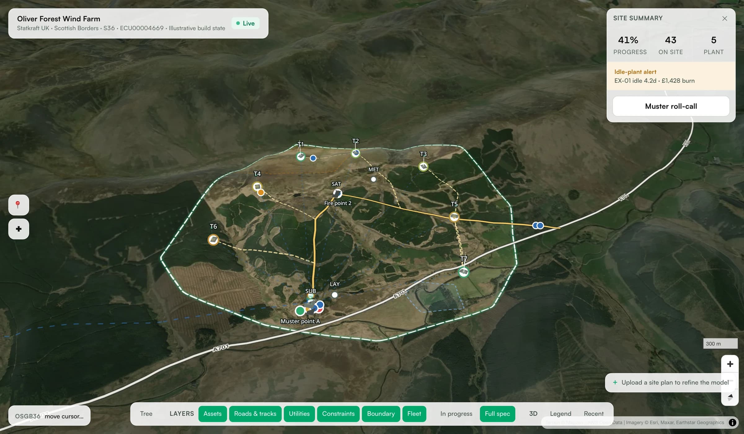
The real product — Oliver Forest demo, built from public S36 planning data.
See it. Prove it. Hand it over.
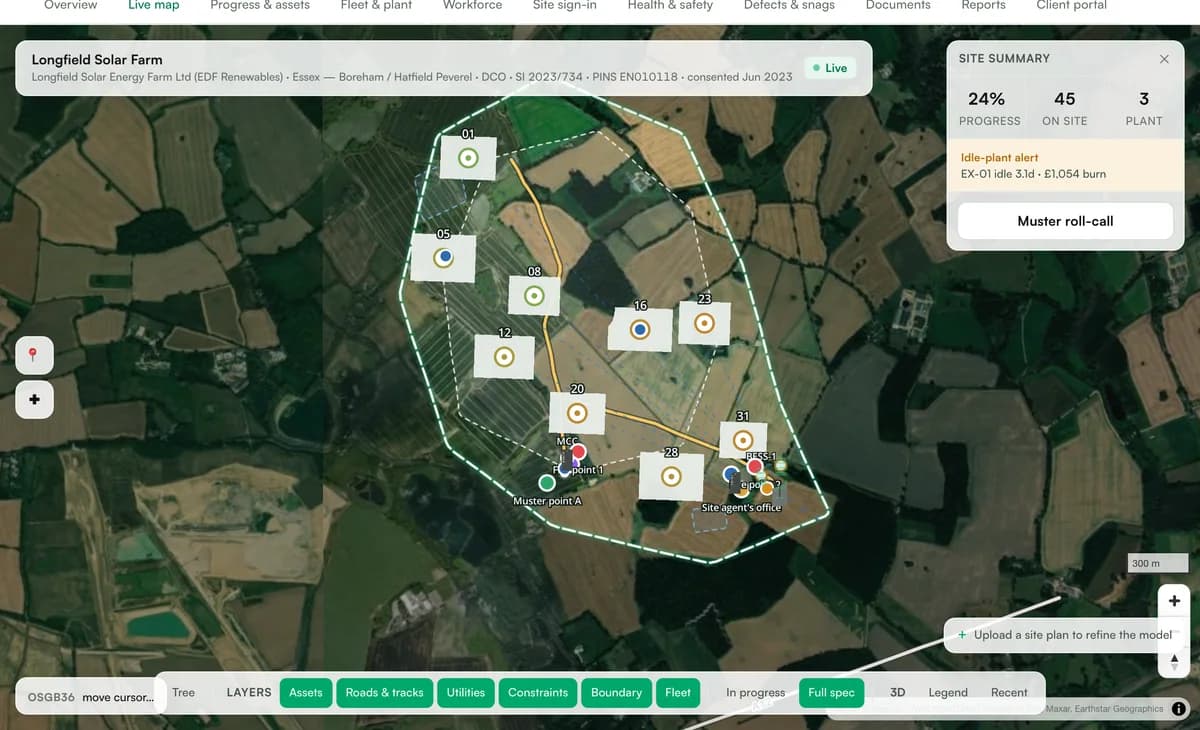
The live map
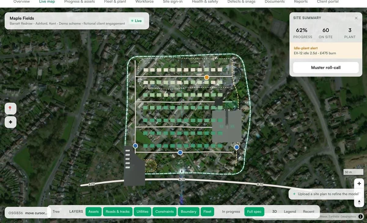
Every asset, track and cable at its true coordinates on real terrain.
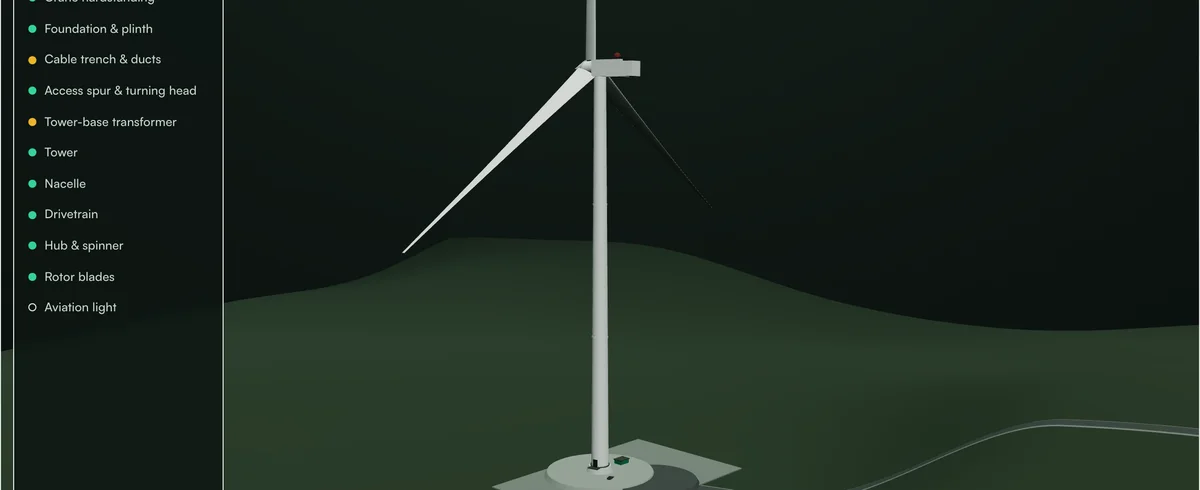
The 3D twin
Each asset generates its model from spec and build stage.
The evidence record
Attributed, time-stamped, located. Reports write themselves.
Click an asset. Get its model.
- ✓Generated from the consented spec — not stock objects
- ✓Built solid · in-progress amber · planned as hologram
- ✓The map renders the same geometry
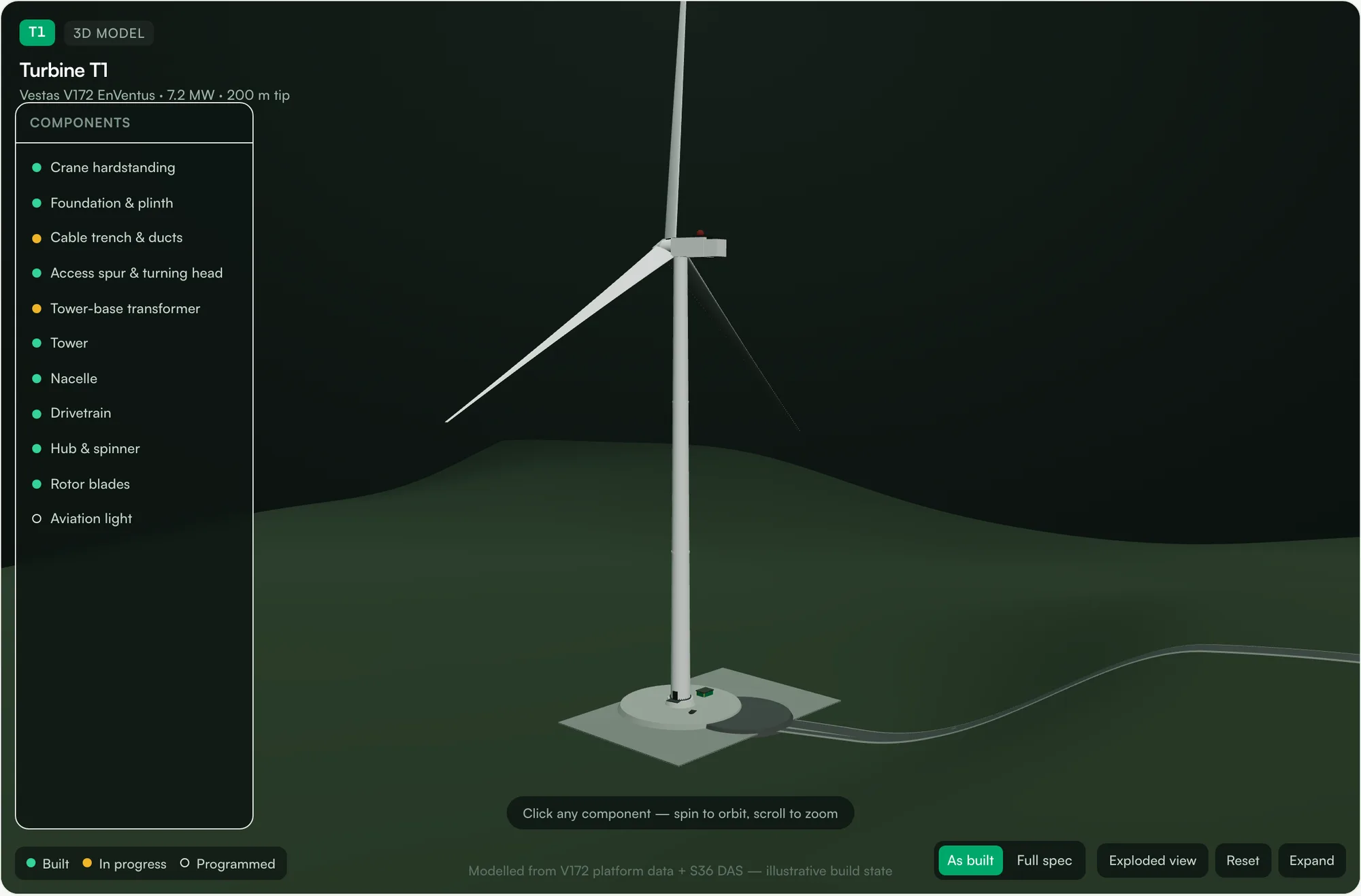
Foundation, tower, nacelle, blades — each carries its own status, spec and records.
Built renders solid, in-progress amber, still-to-come as a hologram of the consented design.
Click any part for its specification, the company responsible, and its photo record.
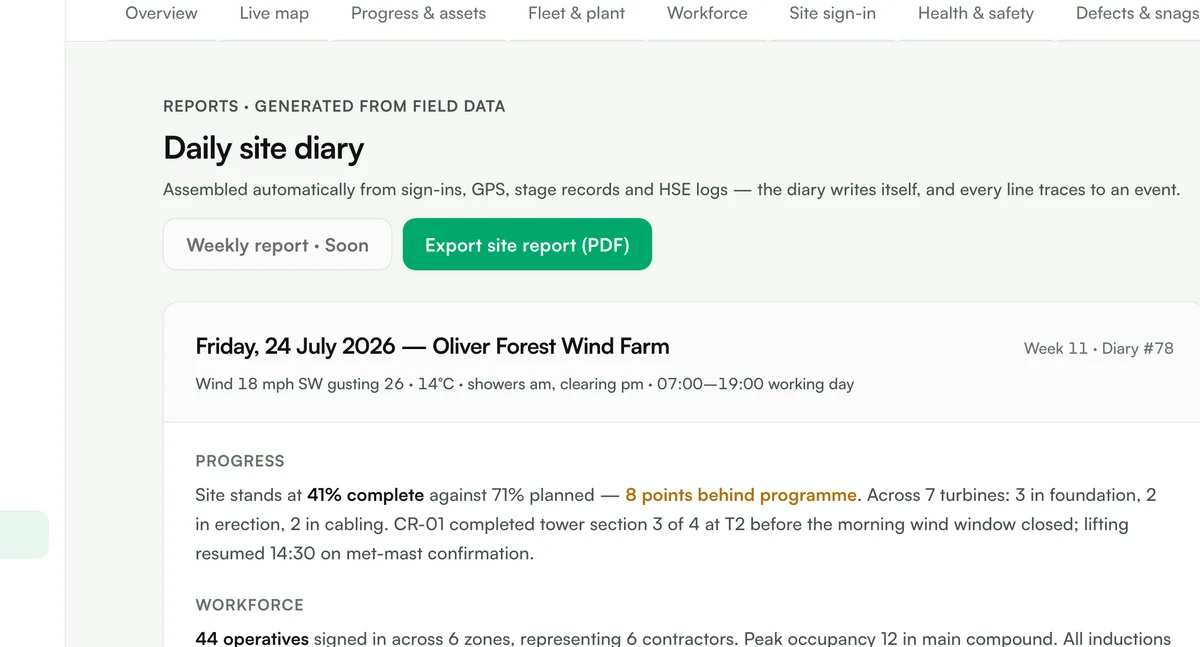
Assembled from sign-ins, GPS, stage records and HSE logs — before anyone opens a laptop.
41% complete against 71% planned, and it says so. The report does not flatter the programme.
Branded PDF today. Scheduled weekly sends and sign-off routing are next.
The report drafts itself.
- ✓Auto-drafted daily diaryCompiled from the live record — labour, plant, weather, progress, incidents.
- ✓Every line traceableAttributed, time-stamped and located, so the number survives a challenge.
- →Sign-off & scheduled sendNextRoute the draft for approval, then send to the client on a schedule.
Every surface, one record.
Live map
500 MW of solar, clickable
3D twin
Models from spec, not stock
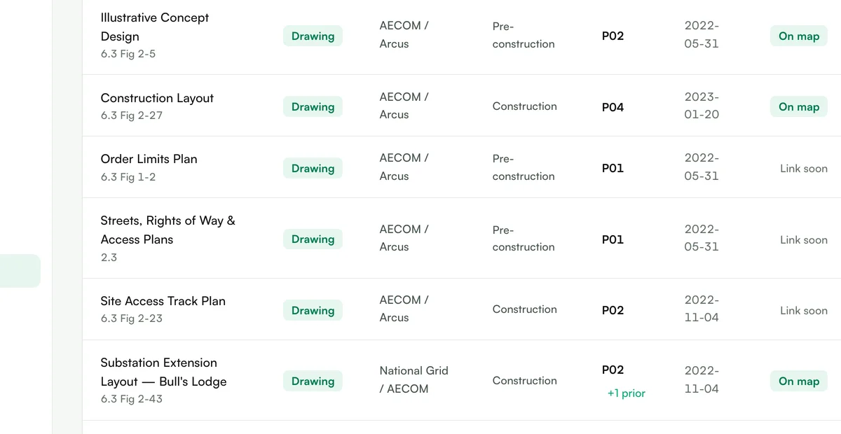
Documents
Real DCO drawings, revisioned
Reports
The diary writes itself
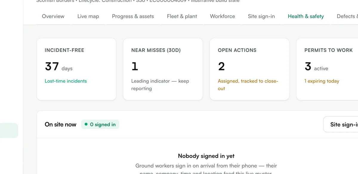
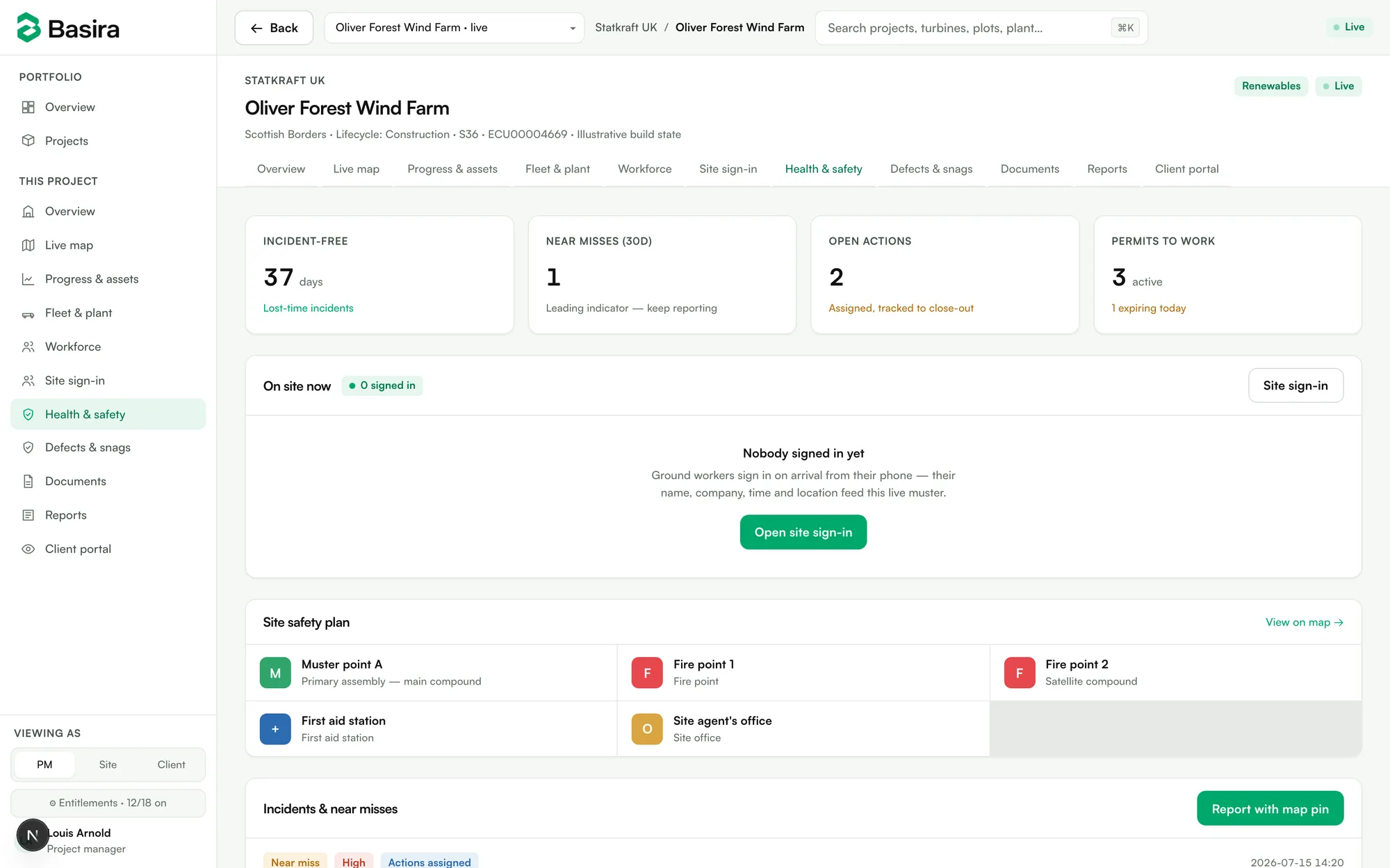
Muster & safety
One-tap roll-call, live
Every vertical
Wind, solar, estates & more
Built for schemes that spread.
Don't take our word for anything.
The demo is live
No form, no gate. Open a real consented scheme and click around.
Public-record data
Coordinates, capacities and drawing numbers from the planning record — checkable. We are not affiliated with the developers named in it.
The golden thread, stated plainly
What the law actually requires — and what software can honestly claim. No sales voice. →
Ready for procurement.
Your record, structured for handover
Who changed what, when — by default
Remote sites sync when signal returns
Records born the way the law describes
We don't replace your programme
Georeference the consent pack, done
Recently shipped.
- Jul 2026Live muster & one-tap emergency roll-call
- Jul 20263D solar arrays — build-stage aware PV models
- Jul 2026Snagging & defects with photo capture
- Jul 2026Real DCO drawing registers, revision history kept
The questions procurement asks.
Does this replace our programme software?+
No. Asta, P6 and MS Project stay. Basira holds the spatial record and the evidence — we integrate rather than migrate.
Our sites have no signal.+
Field capture works offline and syncs later. Photos carry their location and timestamp with them.
Who can see what?+
Role lenses: PM, site team and client each see their slice. The funder view is read-only by construction.
How long until it's useful?+
A site stands the day its consent drawings are georeferenced — one working session.
What happens at the end?+
Everything exports, attributable and structured, because the asset outlives the project by decades.